Mapping the 2026 Israeli Elections
What can we learn from an extremely multi polar political system?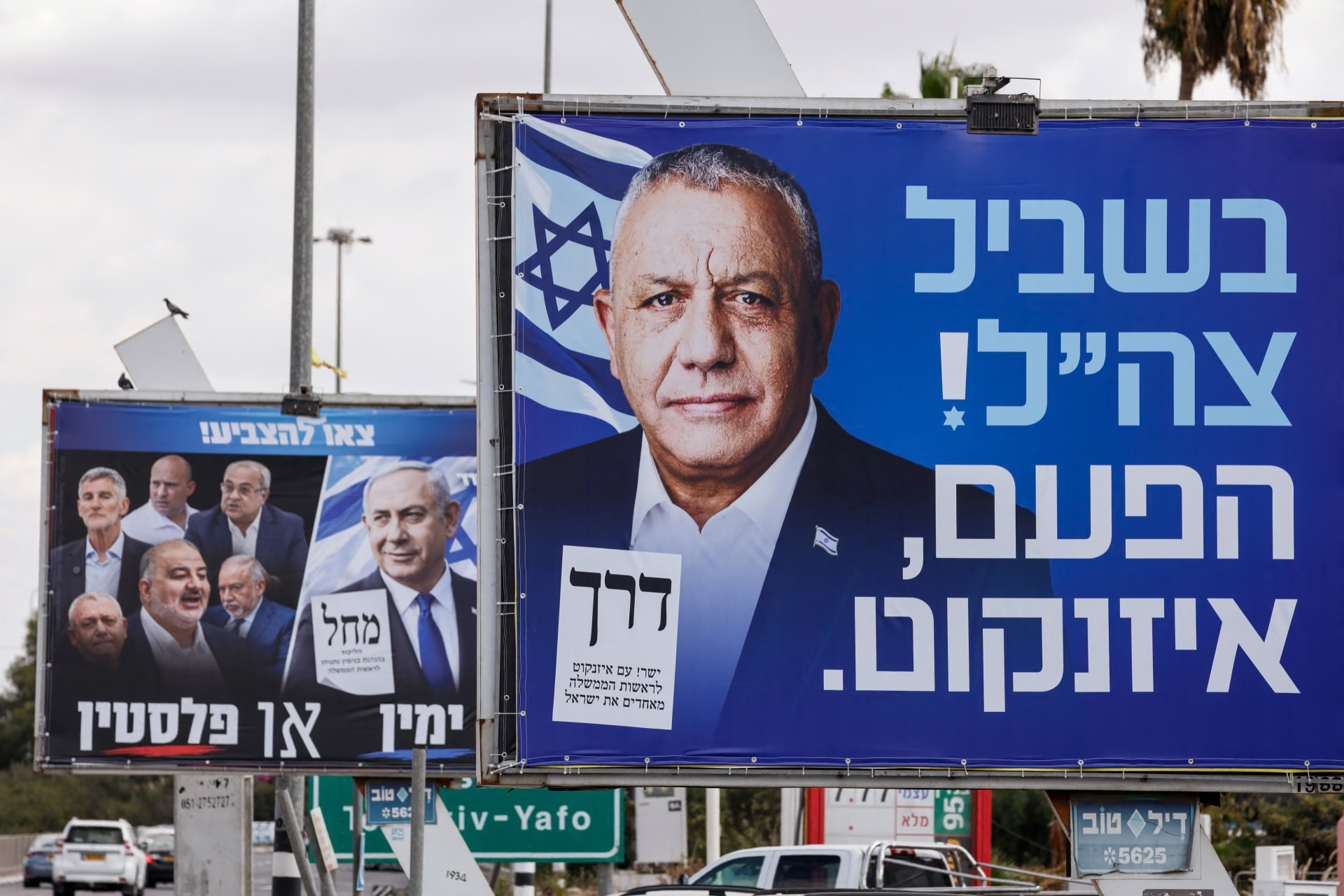
Israel, as keen blog readers will already know, has just held an election. A large-scale exercise to win over the minds of Israeli citizens. Israel elects its parliament by nationwide proportional representation, which makes geography largely irrelevant to commentators, but I thought it would be worth mapping how the results came out by area. With the latest results, alongside historical ones, there is a lot to take in.
So you can look for yourself and follow along, here's the link:
The headline results were that the parties of the 2022 coalition lost their majority, though Likud is still the largest party.
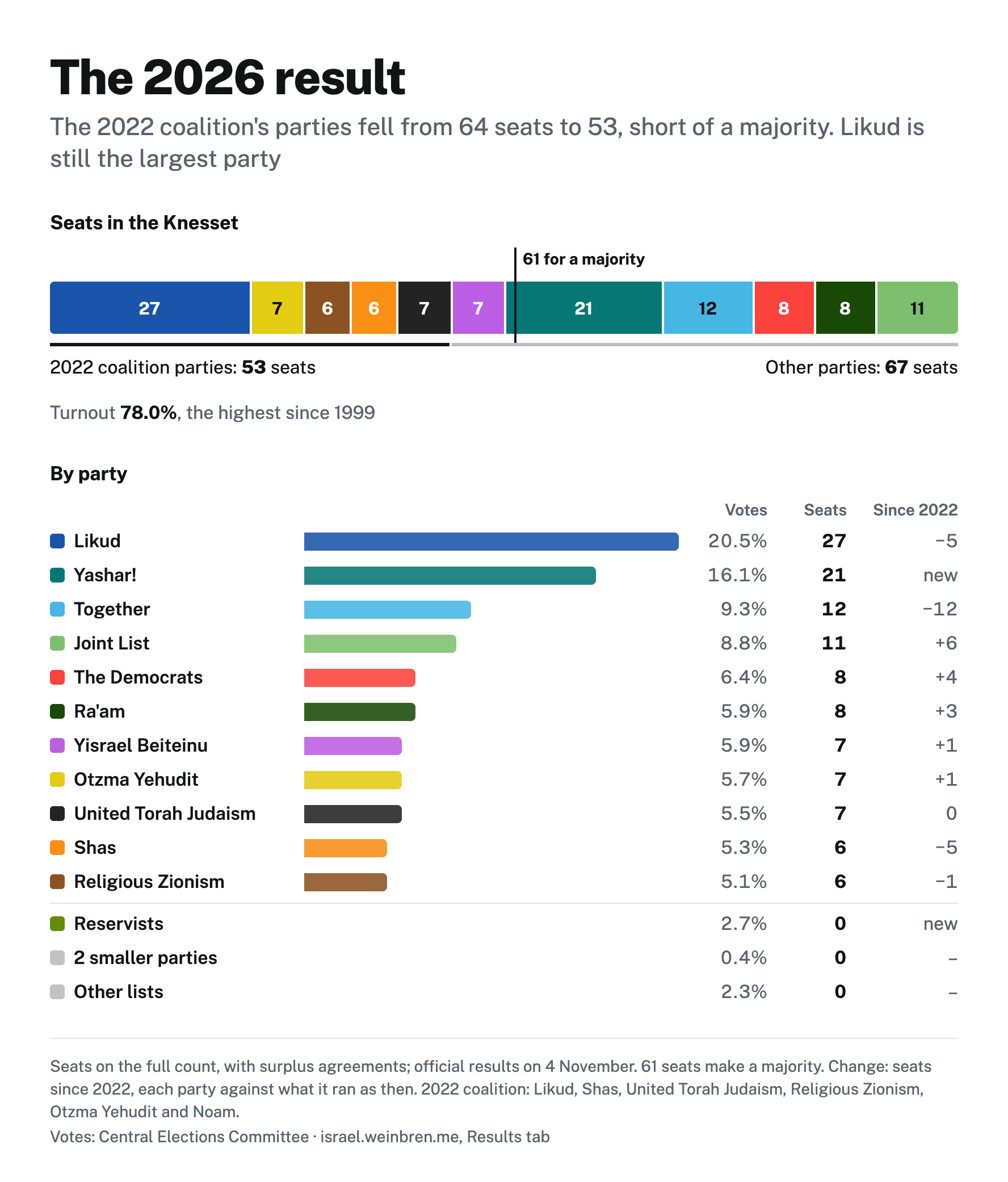
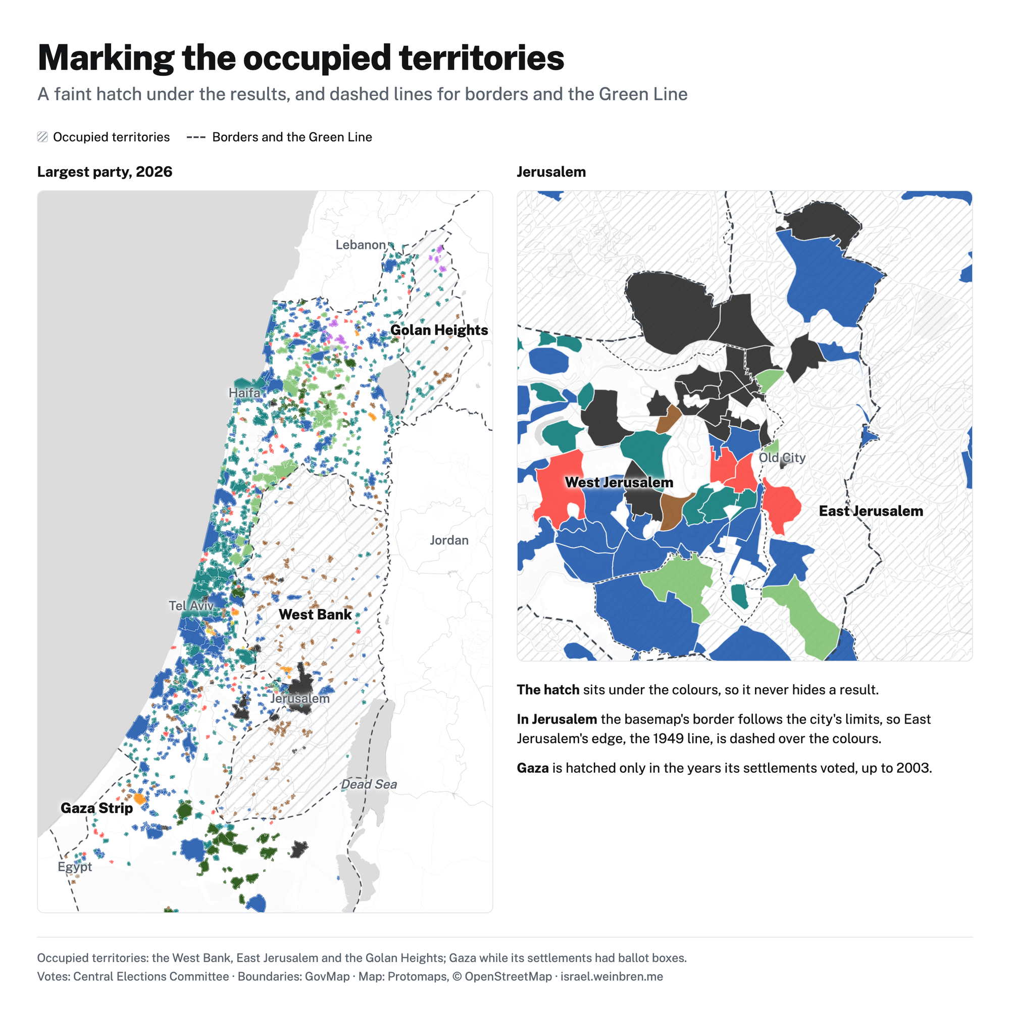
A lot of thought has gone into the classifications and cartography, but inevitably there will be disagreements about how to portray Israel fairly and ethically. I have used hatching for the occupied territories, alongside the Green Line and the line between East and West Jerusalem.
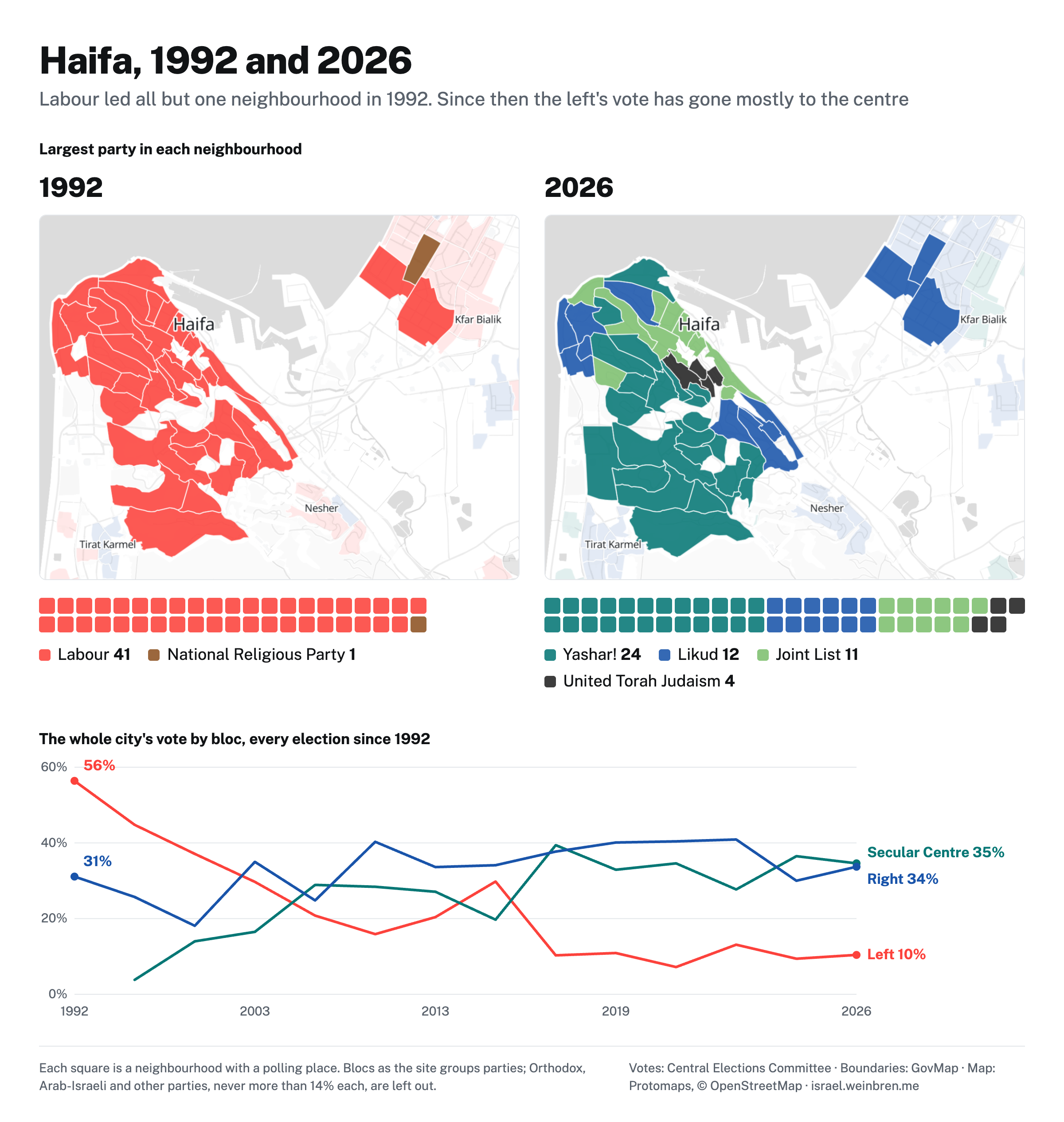
Red Haifa: home of the dock workers whose sweat and labour built the state as we know it. In 1992, Labour led almost every neighbourhood. Since then, blue-collar workers have swung to the right, and much of the rest of the Jewish population to the centre. I have talked and written before about the decline of the Israeli left across much of society, and how this has greatly hurt the chances of peace between Israelis and Palestinians.
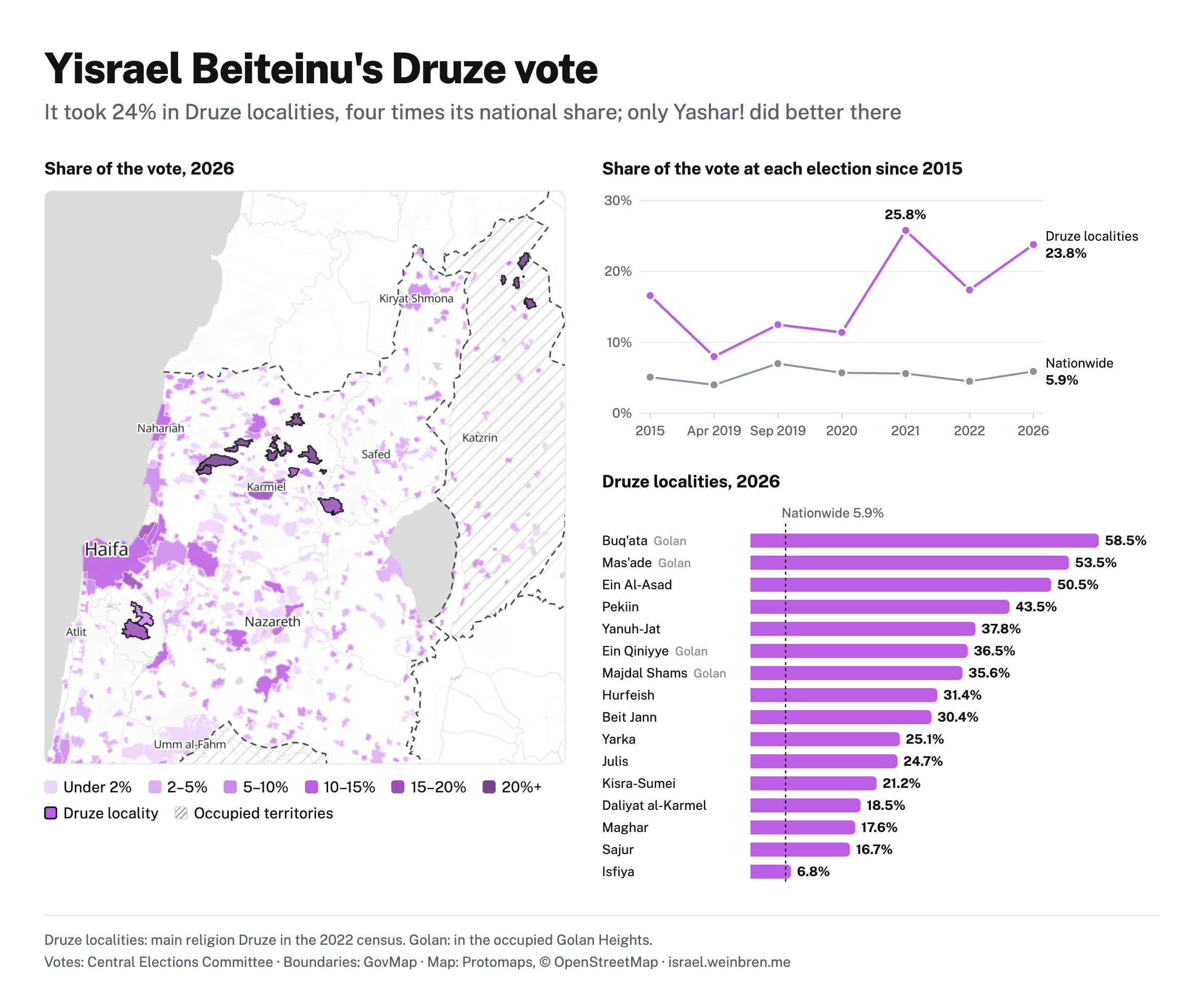
We can also see how particular communities voted. Druze localities, for instance, voted disproportionately for Yisrael Beiteinu, a secular right-wing party built on immigrants from the former Soviet Union; only Yashar! did better there. There are several possible reasons. Druze men are drafted into the IDF, and Yisrael Beiteinu campaigns for military service for all. It has also had Druze MKs, such as Hamad Amar.
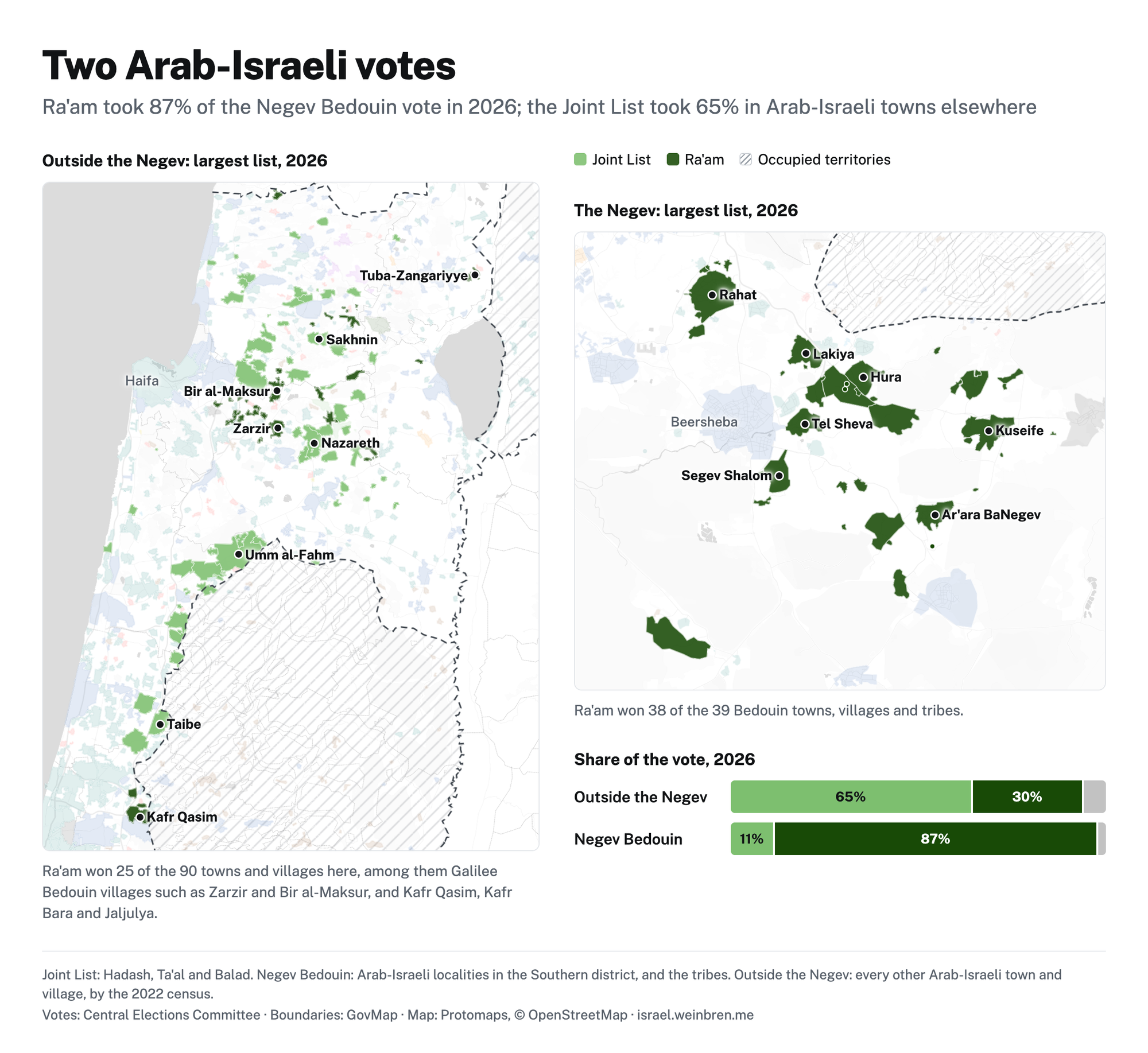
We also see a north–south divide among Arab-Israelis. In the north and centre, the Joint List leads; among the Bedouin of the Negev, in the south, Ra'am dominates.
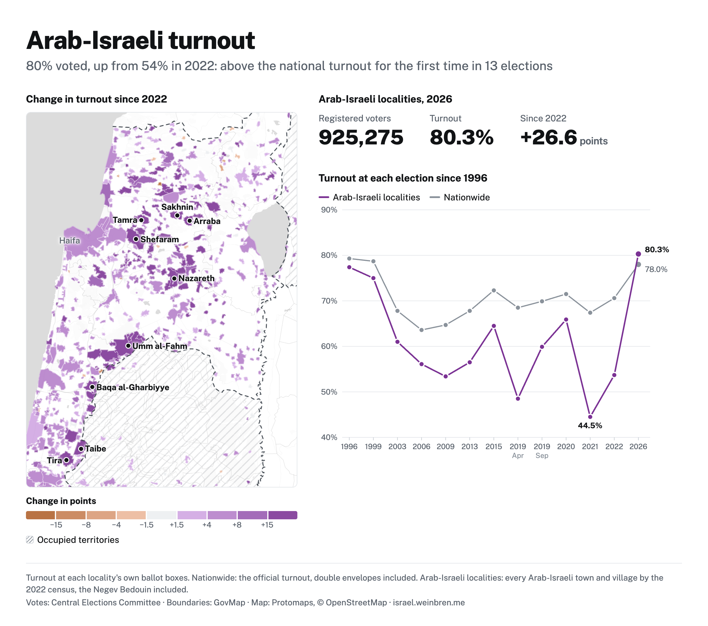
Arab-Israeli turnout, arguably the story of the election, stands out too: in Arab-Israeli towns and villages, it was higher than the national rate for the first time in decades. That, and Balad's return to the Joint List, nearly doubled the Arab-Israeli parties' seats.
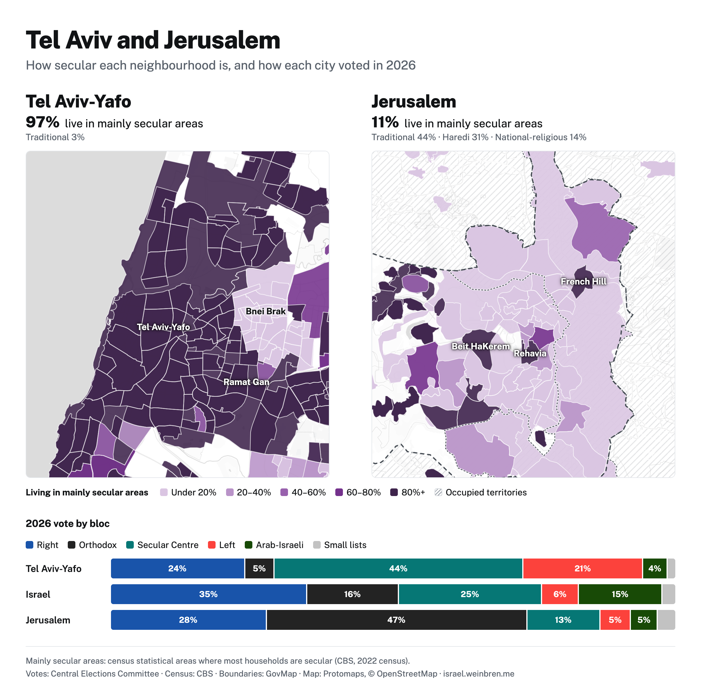
Nowhere is the secular–religious divide clearer than between Tel Aviv and Jerusalem, Judaism's holiest city. You can explore it in the Census tool, and see it in how the two cities vote.
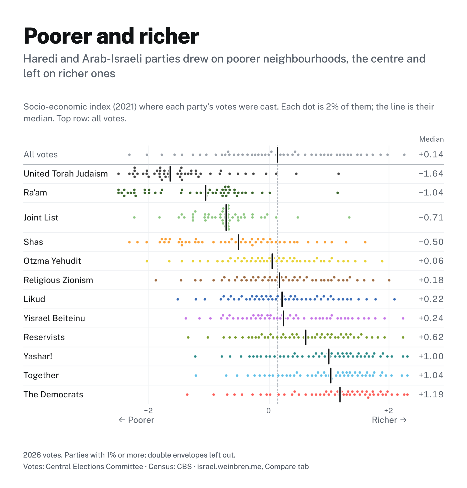
Likud, once known as the party of "Second Israel", now draws on the middle of Israeli society. Meanwhile the centre and left tend to do better in less deprived areas. In contrast, the Orthodox and Arab-Israeli parties do far better in deprived ones.
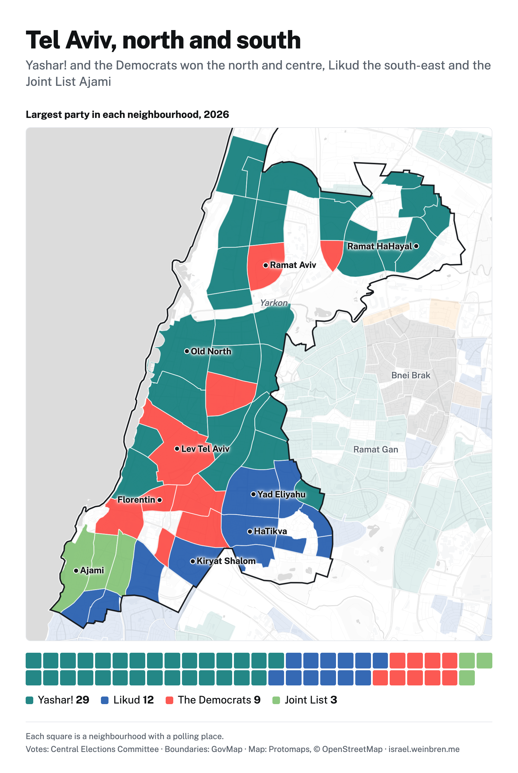
Tel Aviv, the city at the centre of the early Zionist project, is broadly split between a more affluent north and a more deprived south. Its vote shows this too: the north and centre went for Yashar! and the Democrats, the south-east for Likud, and Ajami for the Joint List.
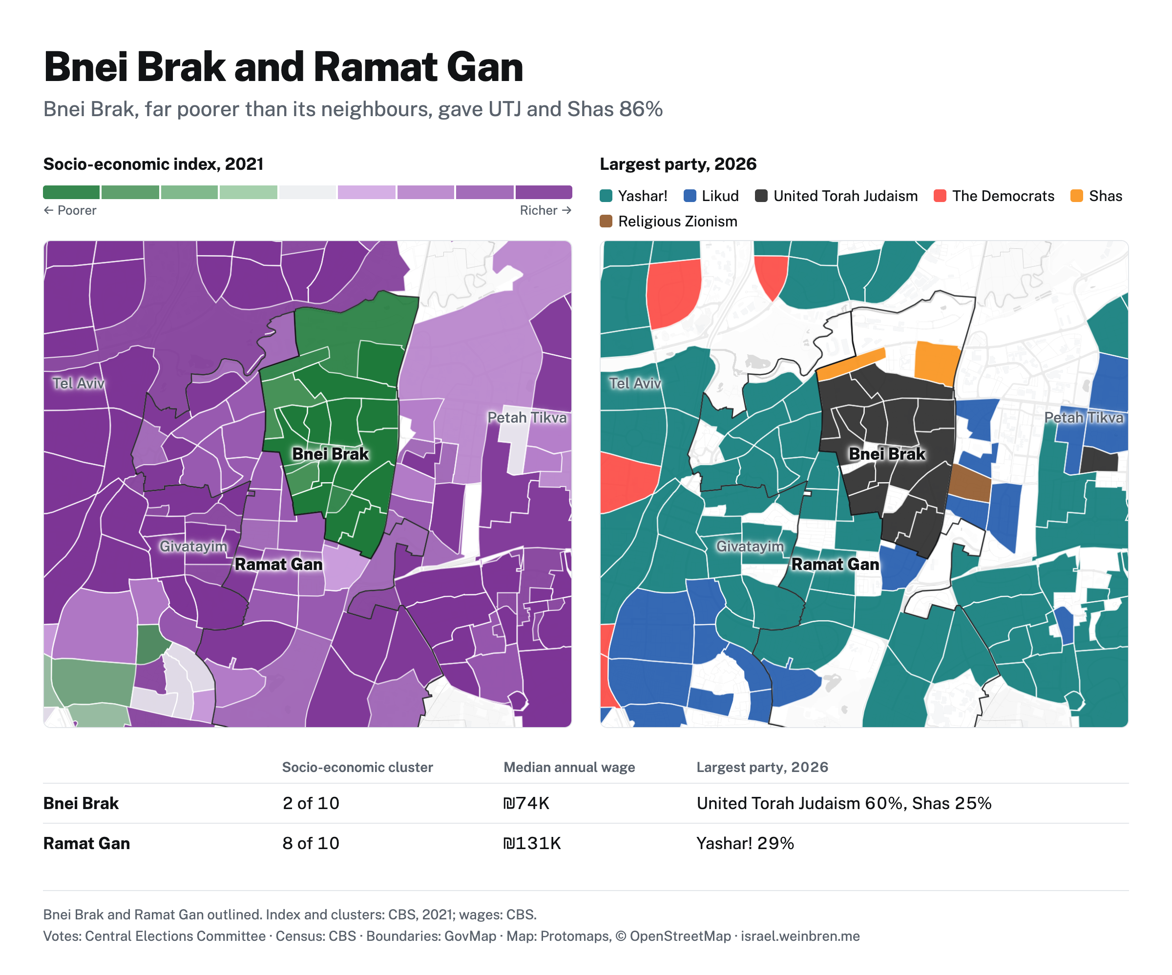
Bnei Brak, right next to Tel Aviv, is overwhelmingly Haredi and far poorer than its neighbours. Whenever I map deprivation in Israel, it stands out.
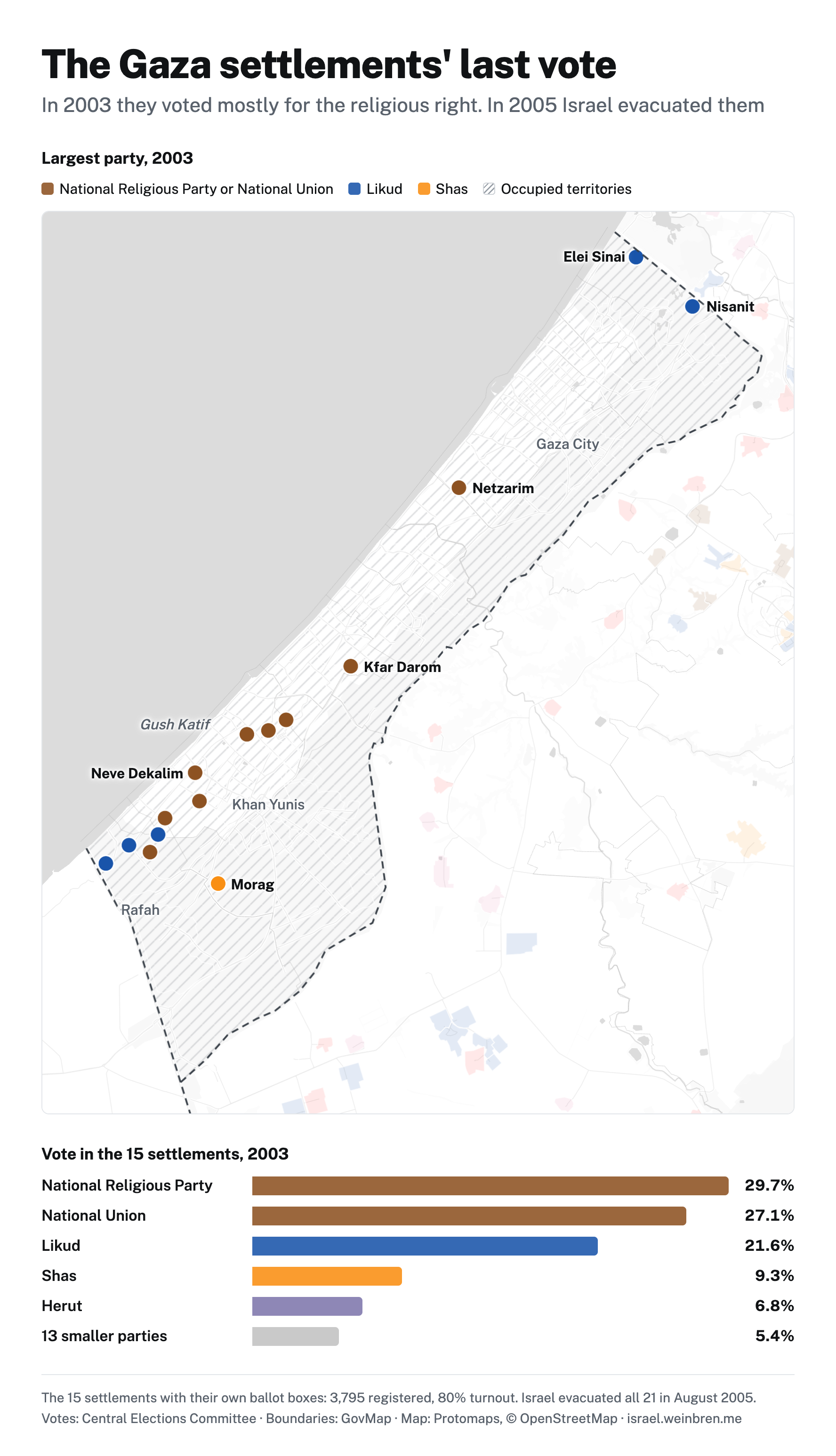
We can also go back in time and see how the Israeli settlements in occupied Gaza voted in 2003. Most of their votes went to the religious right. In 2005, Ariel Sharon evacuated every one of them.
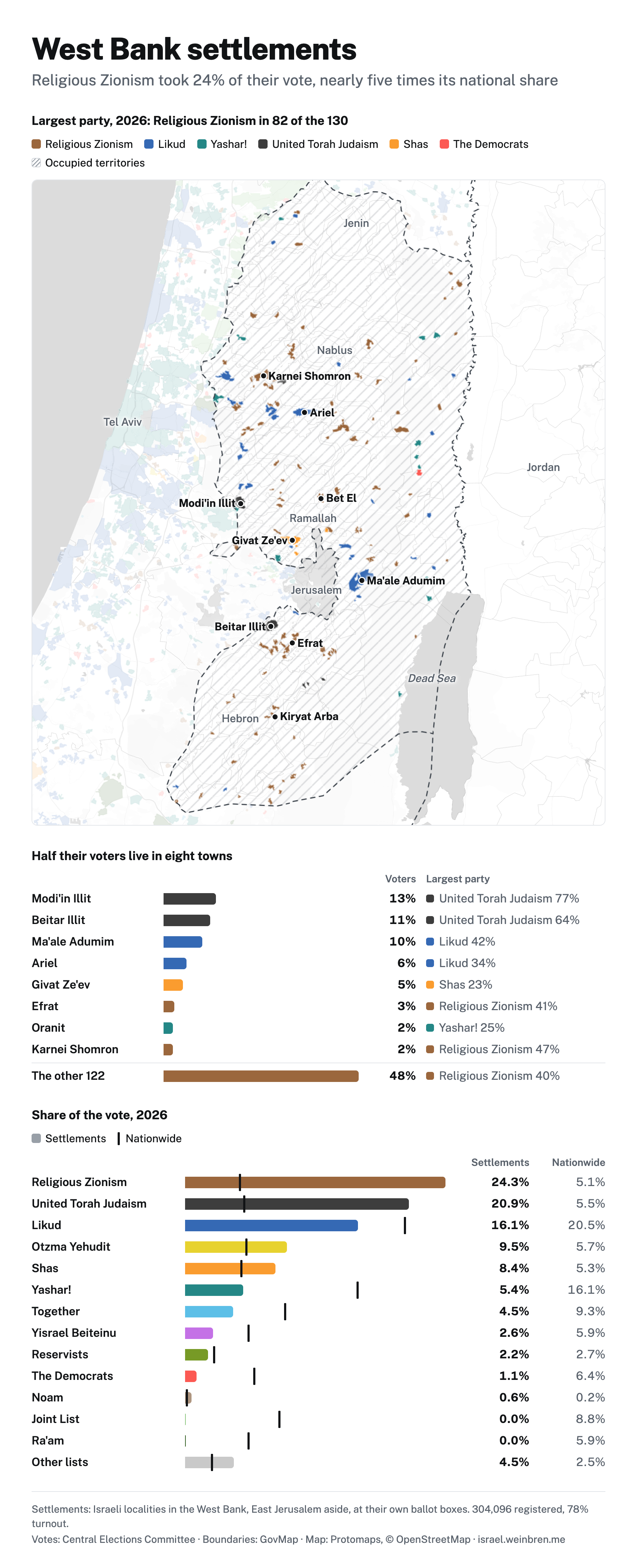
Today's West Bank settlements, central to any peace deal, also back the religious right, and their two biggest towns are Haredi. In these deeply conservative communities, a new vision of Zionism is emerging.
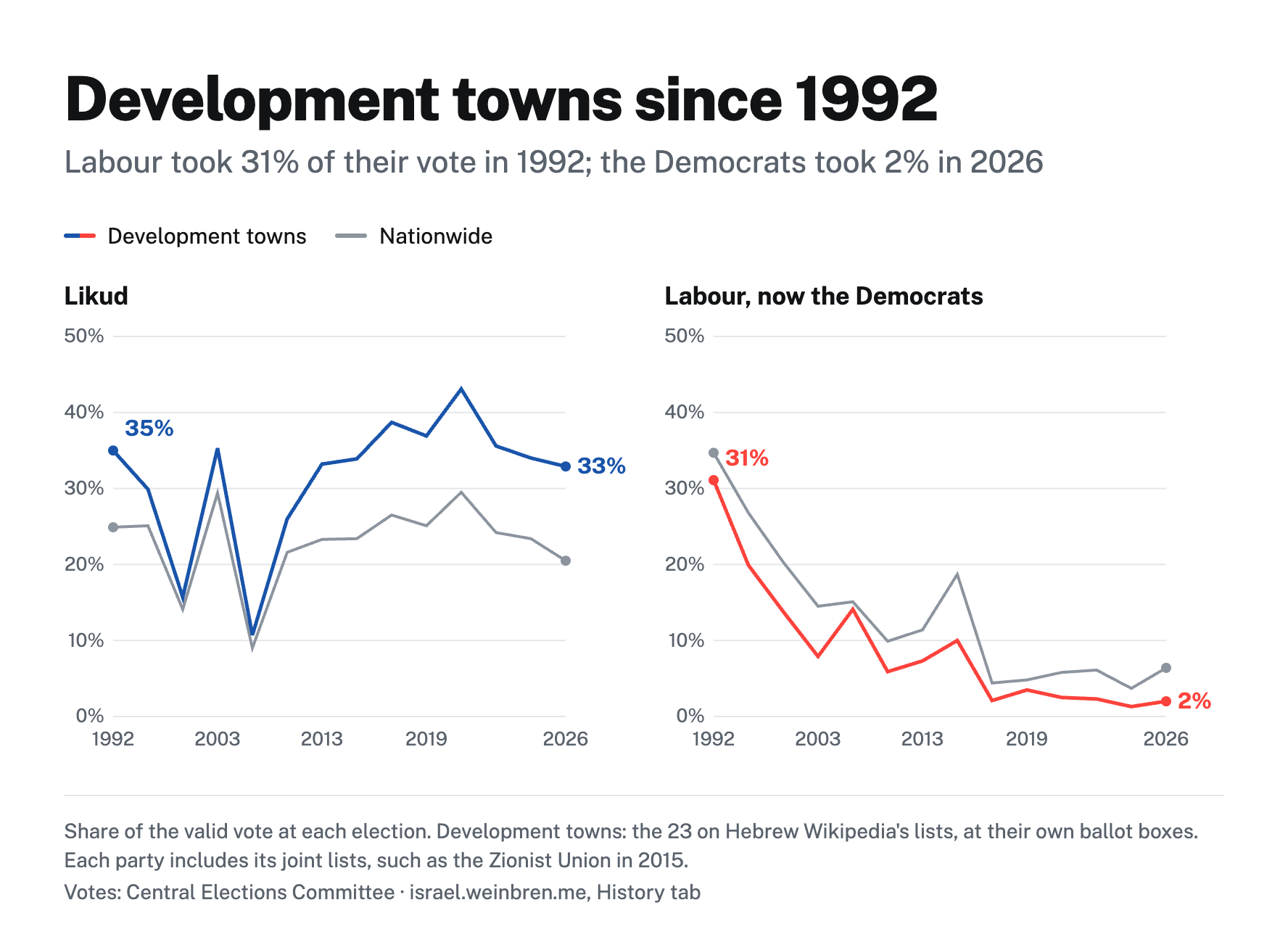
The development towns, built for Jewish immigrants, soon became places of marginalisation in Israeli society. In 1992, Rabin campaigned hard there and promised these communities investment. Today, little of the left remains.
As a final note - the hope of many of us around the world watching these elections is that the Israeli and Palestinian people can live in peace and security. To all those who voted in this endeavour, thank you.